How Deep is Mariana Trench?
Situated right within the western Pacific Ocean, the Mariana 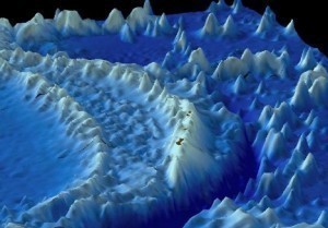 Trench is considered the deepest part of all the oceans in the world. It is a significant part of a system called the Izu-Bonin-Mariana Arc. From the Mariana Islands, people can find it somewhere on the east side. One of its notable features is the Challenger Deep, which is a small valley found somewhere at the floor of the southern end. In addition to these interesting facts, it is also nice to learn the depth of Mariana Trench.
The Depth of Mariana Trench
How deep is Mariana Trench? The maximum depth of Mariana Trench is 36,200 feet or 11,034 meters, which is found at the Challenger Deep. Its mean width only measures 43 miles or 69 kilometers, but its length is 1,580 miles or 2,550 kilometers. In case Mount Everest was set at the lowest point of the trench, almost 6,810 feet or 2,076 meters of water can be measured above it.
Additional Facts and Other Important Details
Through the Challenger expedition, the Mariana Trench was sounded for the very first time. It lasted from December 1872 until May 1876. It recorded a depth of 31,614 feet or 9,636 meters. After that, the Challenger II used echo sounding to survey the trench. This method was easier and more precise in measuring depth compared to the draglines and sounding equipment that were used during the first expedition. It measured a depth of 35,760 feet or 10,900 meters.
After that, a Soviet vessel named Vityaz surveyed the trench once again. This time, it came up with a different measurement, which was 36,200 feet or 11,034 meters. In 1962, the M. V. Spencer F. Baird surface ship used precision depth gauges, which measured a depth of 35,840 feet or 10,915 meters. In 1984, a highly specialized Japanese survey vessel called Takuyo was used to gather all-important data. With the help of a multi-beam echo sounder, it reported a depth of 35,798 feet or 10,911 meters.
In 2003, researchers from the Hawaii Institute of Geophysics and Planetology found another spot along the Mariana Trench similar to that of the Challenger Deep. Based on their reports, this spot could even be deeper. Their research ship towed a special sonar mapping system to survey the trench as well as the surrounding areas. The spot was later named the HMRG Deep, which was taken from the name of the group that discovered it. HMRG stands for the Hawaii Mapping Research Group.
On January 23, 1960, a Swiss-designed deep-diving research bathyscaphe named Trieste reached the lowest point of the trench. Swiss oceanographer Jacques Piccard and U.S. Navy Lieutenant Don Walsh were some of the notable individuals who were involved in that successful descent.
